

RADAR-EYE: Road monitoring using cutting-edge radar-based Technologies
Convocatoria: Consolidación Investigadora 2024
Financiación: Financiado por MICIU/AEI/10.13039/501100011033
Referencia: CNS2024-154766
SUMMARY
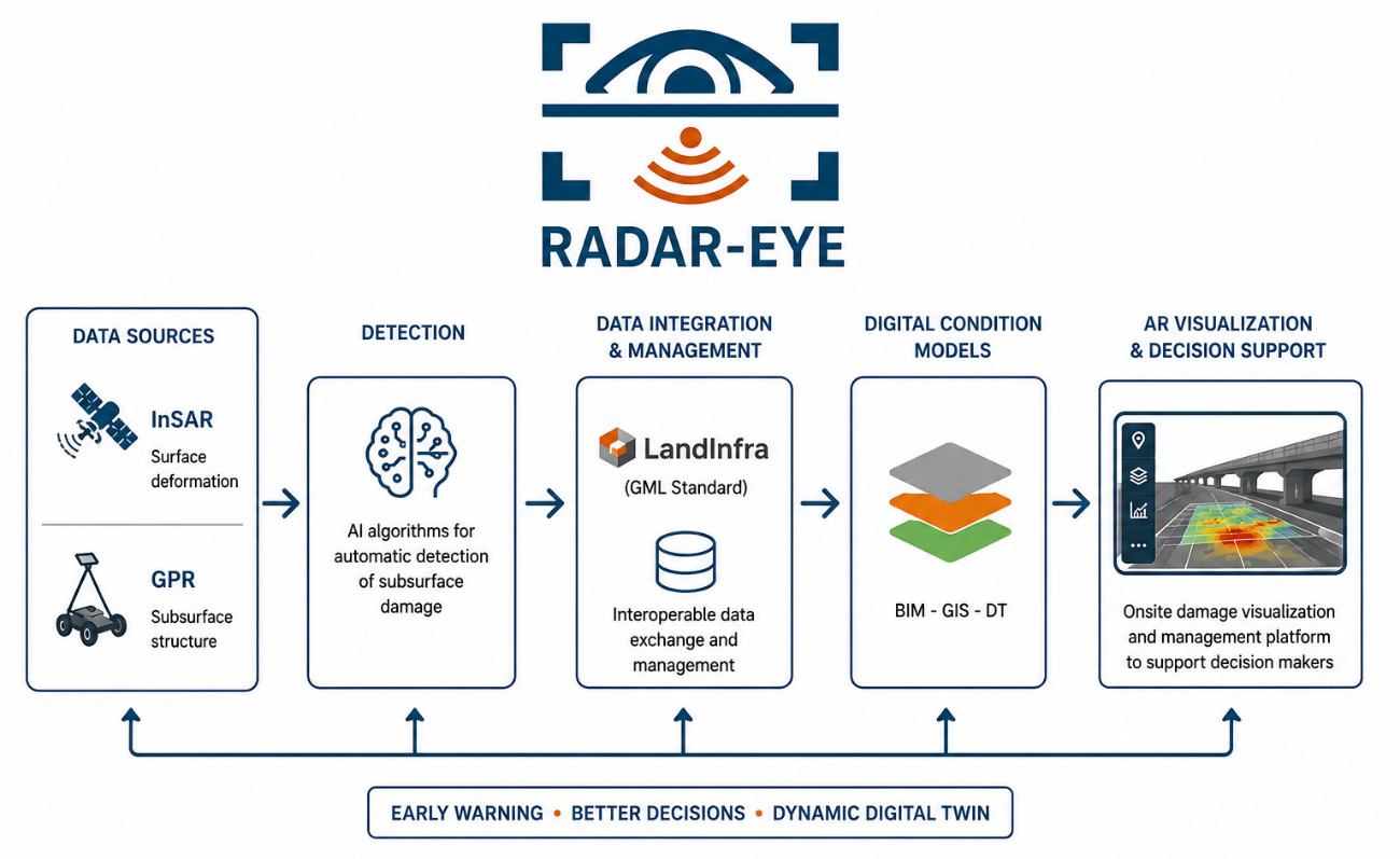
RADAR-EYE leads to develop an innovative solution for an automatic recognition of existing subsurface damages, to have an up-to-date overview of the real condition of road pavement structures, in combination with a decision-support system. The combination of radar techniques, Interferometric Synthetic Aperture Radar (InSAR) at network level and Ground-Penetrating Radar (GPR) at project level, is proposed. Thus, the InSAR can monitor thousands of kilometers of roads all at once, cheaply and without traffic interruptions, alerting about critical areas suffering of ground and structural movements (subsidence and potential sinkholes, displacements in transition zones, etc.). Then, punctual onsite GPR surveys can be conducted in the areas informed by InSAR, as it provides more ground penetration and detail in damage detection (voids or cavities, moist areas, layer thickness deficiencies, etc.).
Following the state-of-the-art, the general objective of RADAR-EYE aims to develop an innovative and competitive solution in order to provide an early warning of subsurface damage in road pavements based on InSAR and GPR data. New procedures and Artificial Intelligent algorithms will be developed for the automatic detection of damages. Nowadays, transport infrastructure (TI) digitization is gaining popularity for monitoring and maintenance strategies, as reliable and effective information exchange is crucial to any industry. Misinterpretations or delays directly translate into increased cost and time requirements. TI are long-lasting investments that shall be functional for many decades and must deal with different domains and large amount of data that needs a collaborative environment to work together. This requires a framework for semantic integration of data sources that must deal with different types of data exchange standards. A standardized pipeline will be therefore developed for interoperable data exchange and management using the OGC LandInfra (GML) standard. The usage of a standardized data format, which is not controlled by any specific software producer, may simplify the implementation of BIM-GIS and dynamic digital twin methodologies, which shall be independent of the software suites employed by the project agents. Finally, an Augmented Reality tool will be implemented to provide an easy and intuitive onsite visualization of all the data, highlighting the damages over the real world and functioning as a management platform on which onsite decisions can be made, thus supporting decision makers.